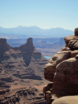
Dead Horse Point State Park
June 1, 2014

If you click the map, you’ll see just a part of it expanded—the part that shows the routes we took from Moab to get to each of the parks. It shows where we entered each park, but not where we went once we were inside. The expanded version doesn’t give you the full overview, but at least the labels on the map are big enough to read.
The name of Dead Horse State Park is said to have come about as follows: in the old days, cowboys used to round up wild horses by driving them onto the point, which has a narrow neck and then opens out a bit—a spoon-shaped peninsula, like Boston in its early days. When the cowboys fenced off the neck, it became a natural corral, encircled by steep cliffs than horses couldn’t negotiate.
At some point, it’s said, a herd of mustangs was abandoned there, and died of starvation and thirst within sight of the Colorado River 2,000 feet below. Apparently no one has succeeded in finding reliable evidence that this actually happened, because the story is generally described as a legend.
Dead Horse Point State Park isn’t far from Moab, at least by air, although the terrain makes the roundabout drive to get there a little longish. You can see the route if you expand the map above. (It shows how we got to the park, but doesn’t trace our route inside it.)
Photo Notes

It takes 300 days of sunshine to get the water out of a full section. To aid this process, the company adds blue dye, which darkens the brine to make it absorb the sun’s light and heat more efficiently. (I don't know why it looks dark and almost purple in the Google Earth picture above, but this probably has something to do with the picture being taken from outside the Earth's atmosphere. To my naked and earthbound eye, the ponds were the same bright azure you can see in the photos we took.)
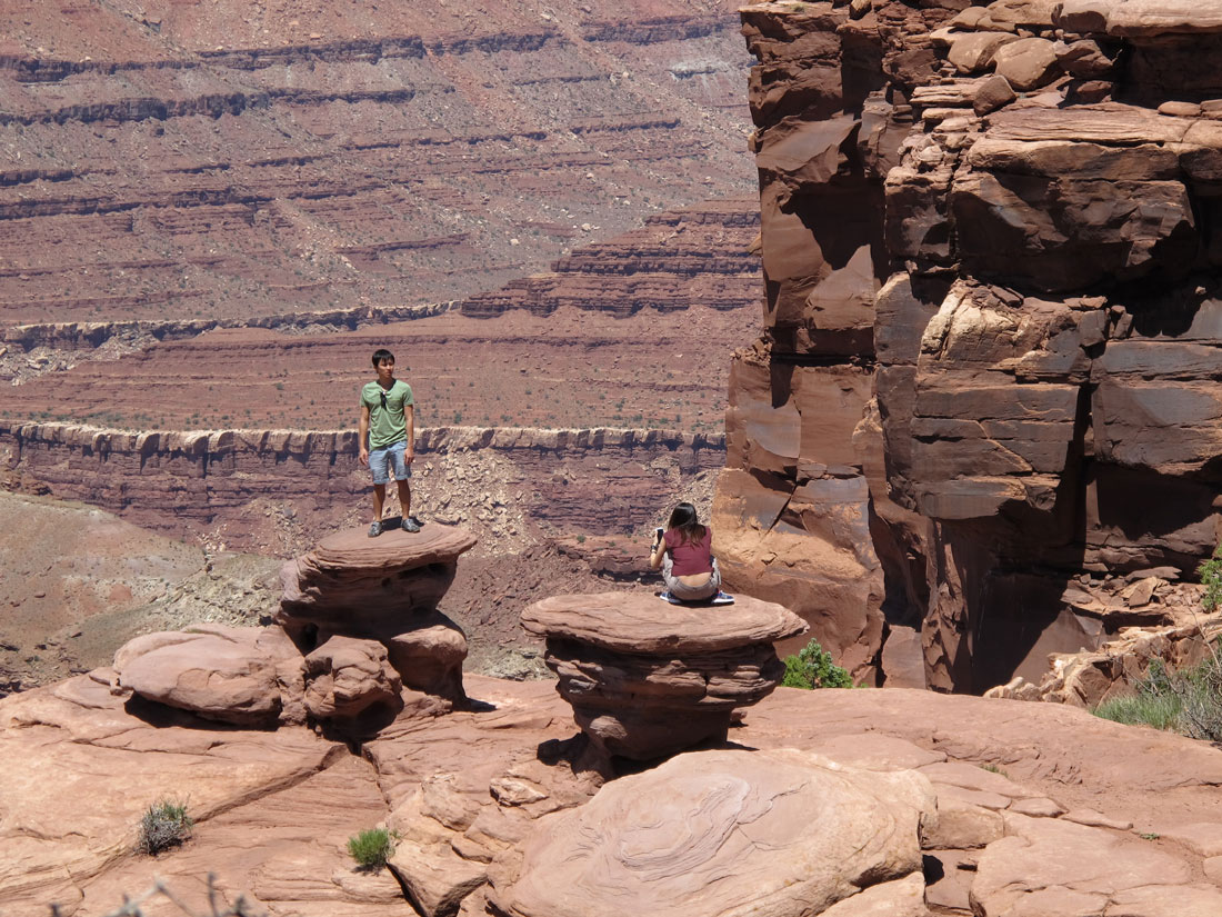
Photos #21 and 22 include a couple of youngsters who were (rather daringly) making use of the landscape as a portrait backdrop. I waited for them to move on so I could take my usual unpopulated shot. But it was clear that they were in no hurry, and it soon dawned on me that the pictures would probly be better with those kids in them than without.
Site Map
Home
Navigation and Display
Where We Went
Colorado National Monument
Gallery Notes
Colorado River Valley
Gallery Notes
Arches National Park
Gallery Notes
Dead Horse Point State Park
Gallery Notes
Canyonlands National Park
Gallery Notes
Lake Powell Boat Trip
Gallery Notes
Canyon de Chelly, Inside
Gallery Notes
Canyon de Chelly, North Rim
Gallery Notes
Canyon de Chelly, South Rim
Gallery Notes
Cumbres & Toltec Scenic Railroad
Gallery Notes
Garden of the Gods
Gallery Notes
Faces